→ Operational Plan for Securing Public and Community Spaces (ESEKK) of the Municipality of Athens:
Laying the foundation for the expropriation of green spaces and public-use areas across the capital.
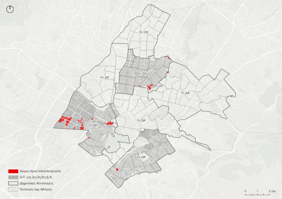
The project concerns the preparation of the Operational Plan for Securing Public and Community Spaces (ESEKK) for the Municipality of Athens, in accordance with Article 92 of Law 4759/2020. The plan records, evaluates, and prioritizes all public and community spaces designated in the approved town plan that have not yet been expropriated, providing the Municipality with a robust decision-making tool for prioritizing future expropriations.
Gimisis+Associates participated in the project as a subcontractor to the lead consultant, Horometria Consulting Engineers, undertaking responsibility for Municipal Communities 2, 3, and 6. The scope of work included the assessment of 142 potential expropriation sites and the review of 198 town plan reservation areas. As part of the assignment, the team conducted archival research at the Municipality’s competent department to identify and examine the original expropriation records for each site, including cadastral and topographic plans, land readjustment acts, Government Gazette expropriation decisions, and accompanying property ownership schedules. These records were compiled into a unified digital geodatabase with a standardized data structure and coding system for all spatial entities, in accordance with the project’s technical specifications.
In addition, Gimisis+Associates designed and developed the prioritization methodology applied throughout the project. The methodology consisted of a weighted multi-criteria assessment combining geospatial characteristics of each site—including distance to the nearest secured public space, population served within an 800 m radius, site area, legal status of the expropriation process, and designated land use—with qualitative assessments provided by the Municipality regarding local conditions that could not be captured through spatial data alone, such as political priorities, pending administrative procedures, or the need to complete the pedestrian network. The automated workflow generated a final priority score for each site, providing the Municipality of Athens with a transparent and evidence-based tool for prioritizing future expropriations across all seven Municipal Communities.
Alongside the development of the geospatial database, the company contributed to the preparation of the Technical Reports for each Municipal Community, including the documentation, evaluation, and cartographic representation of every designated public and community space, together with tailored recommendations for future municipal actions.
- Project AuthorityGreen Fund
- Study Area Extent (ha)38,96
- Project BudgetEUR 116,400 (excluding VAT)
- Primary Land UsePublic and Community Spaces
- LocationAthens
- Administrative JurisdictionMunicipality of Athens